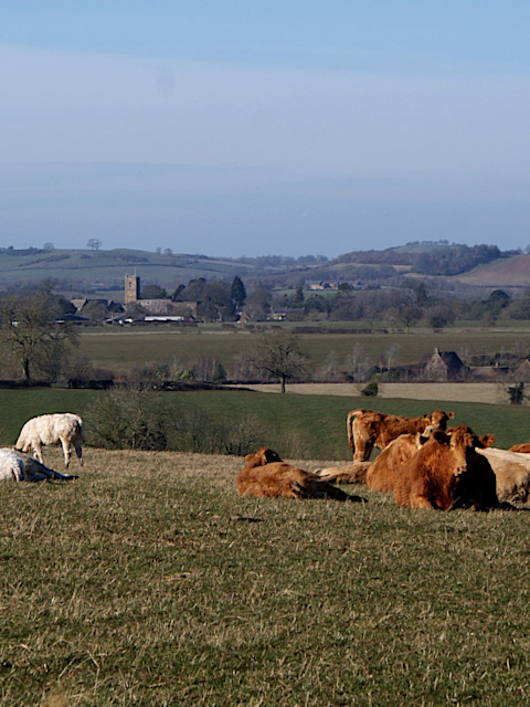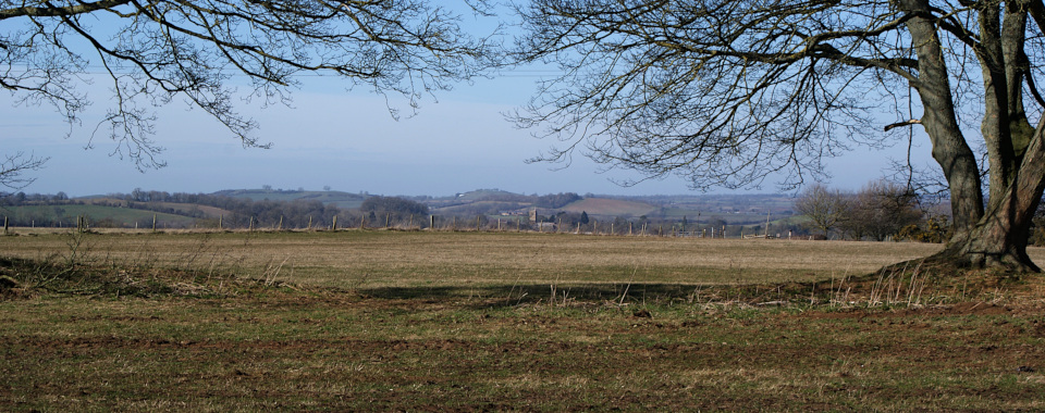


Rising to almost 200 metres/656 feet, Tadmarton Heath is a watershed:
On three sides the land drains to Tadmarton Stream and the River Swere, which flow to the Thames Estuary; to the north-west, the land drains to the Warwickshire Stour and the Severn Estuary. Along the ridge-lines rising to the summit run likely prehistoric and minor Roman tracks. And through the middle of it all, passing through the Iron Age settlement, ‘Tadmarton Camp’, runs the Medieval ‘Cotswold Ridgeway’.
Given the significance of the location, it’s no surprise that this broad, long hilltop has many Roman and earlier sites and remains. Though by Medieval times, the settlements had moved down into the flatter, more fertile plains below, away from the acidic heathland.
 © 2023 Paul Mobbs; released under the Creative Commons license.
Created: 19th April 2021;
Updated: 21st April 2023.
Length: ~1,000 words.
Location: Tadmarton/Wiggington, Oxfordshire.
Type: ‘Camps & Settlements’.
Condition: Largely destroyed double-walled Iron Age settlement, with Roman and earlier settlements and earthworks, much of which have been ploughed-out.
Access: Public road and bridleway around the settlement earthwork; other sites have no access.
OS Grid Ref.: SP387356.
Further information: British History On-line.

The light and dusty Northampton sands that make-up the surface of Tadmarton Heath are brilliant for golf course construction. Unfortunately they’re not very good for preserving the structure of ancient earthworks and archaeological remains.
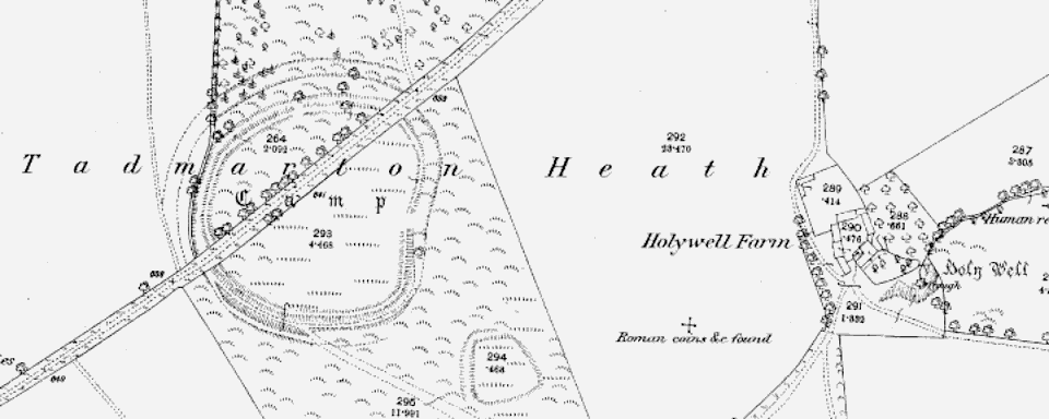
The acidic nature of Northampton sand, which is what creates the classic heathland ecology, is also pretty poor for the preservation of any organic or metallic remains buried there. Little remains to be seen within this historic landscape today, as, just like the scrubby heathland habitat shown on the 1881 Ordnance Survey map, much of it has been lost to time and especially the plough.
Tadmarton Heath is a curious place. It’s the meeting point for both ancient British and minor Roman roads, the routes of which persisted almost until the modern era as drove roads: Most importantly, the ‘Cotswold Ridgeway’ – known in local Eighteenth Century records as the ‘Great Road’ – vital to exporting the wool of the Cotswolds to the ports of Norfolk and The Wash where it was shipped to Europe.
Perhaps that ancient significance as a meeting point is why the boundaries of five parishes with Saxon roots – Milcombe, Wigginton, Hook Norton, Swalcliffe, and Tadmarton – all meet at the top of the hill where these ancient tracks cross. The field boundaries suggest that those six roads, unlike the remaining five meeting at two junctions a short distance apart, in fact met in the same spot – called, notably, ‘Highways Farm’.
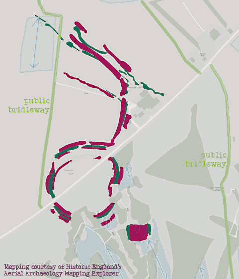
Further to the west down the ‘Cotswold Ridgeway’, the 1881 Ordnance Survey map marks a second, much smaller Iron Age single-walled settlement. This was present on the 1946 aerial mapping, but – like ‘Madmarston Hill’ to the north – had been destroyed by ploughing by 1970.

On the southern flank of the hill, towards Wiggington, there are the remains of Iron Age or Romano-British settlements. Again, these have been mapped from the crop marks found from aerial surveys. This suggests that the heath was in use for many centuries, but by the early Medieval these communities had shifted to the Saxon settlements in the valleys either side of the hill.

Tadmarton Camp is a 165-metre diameter double walled Iron Age hill fort, sitting just away from the location where the trackways converge. Eroded by time, and the construction of the golf course to the south, the best place to see it is the bridlepath that runs around the north-west side towards Tadmarton.
The listing for the site gives little useful detail. The settlement was most likely constructed around the same period as nearby ‘Madmarston Hill’ or ‘Rainsborough Camp’; at least 2,500 years ago, in the late Bronze Age or early Iron Age. It is smaller than either of those sites, though, and the lack of archaeology makes putting detail on that broad history very difficult.
What excavations there have been produced some late Bronze Age, and also Roman artefacts. And though there was a lot of activity around here in Saxon times, this high and sometimes weather-beaten location never developed any significant settlement of its own.

More than anything, what this location makes me think of most is the folklore of the mythical ‘crossroads’. The fact that this has been such a travelled point in history, for millennia, but that very little evidence of that human interaction remains today, speaks to the impermanence of people and their material creations. In those mythical tales, people go to such lonely ‘crossroads’ to do deals with the devil. As five roads still meet here today, that must make this spot 25% worse!