Paul Mobbs’ photographic record of his walks around ‘Banburyshire’ and ‘The Irondowns’, and occasionally, as part of his work around Britain, the areas beyond.
The route of HS2 through the Chilterns has exercised many people's attention. Even so, in North Buckinghamshire beyond Wendover, the line still cuts through a unique flat clay landscape that, despite historic quarrying and landfilling, has remained relatively undeveloped – and remote enough from major transport routes to have remained relatively tranquil.
Click on blobs to access the page for that location
Emerging from the 'Chilterns Tunnel' at South Heath, HS2 moves along a cutting along the east side of the Misbourne valley – until it crosses over and falls to ground level south of Wendover. From there it crosses the flat Aylesbury vale, skirting just west of Aylesbury, before passing between the pinch point of the Quainton and Waddesdon hills.
Following the existing (freight only) railway line, it crosses the Oxford to Cambridge line near Calvert (disused, but currently being reconstructed as part of 'East-West Rail') – where the depot for the line will be located (the blue star on the map).
Access to the route between South Heath and Waddesdon is very easy, with numerous well-maintained paths over the surrounding hills. The Chiltern Line to Great Missenden, Wendover, Stoke Mandeville, Aylesbury and Aylesbury Vale stations gives easy access via the numerous footpaths in the area.
North of Aylesbury access to the countryside is less well maintained, with less paths in comparison to the Chiltern Hills. Buses running towards Buckingham and Bicester provide (infrequent) access to the more remote countryside in the north of the county.
To view a scene click on one of the numbered blue dots on the map. This will take you to the page for that scene. To return to this index just click 'back'. Otherwise browse the list below to view the scenes in this area.
Approaching Wendover Dean from the south the Misbourne valley flattens before it drops into the Aylesbury Vale at the Wendover gap. To traverse a small side valley running up to Kingsash, HS2 passes from a cutting over a large viaduct and then back into a cutting once more.
From just north of Great Missenden the valley forks and a long ridge rises up, providing a wonderful walking route, through woodlands a lanes. Opposite, you will get a view of where HS2 will emerge from the Chilterns Tunnel.
The footpath to Park Farm leaves the dry bed of the River Misbourne, and via a convenient underpass, rises up the side of the valley towards the top of the ridge. I've come here today to make a photographic baseline of the area before construction… Too late! It's started!
Directly out of Great Missenden, walking up Frith Hill, the footpath eventually levels out and you arrive at a patch of woodland which covers some old earthworks. This is where HS2 emerges form the Chiltern Tunnel into a cutting on its route north.
This isn't tranquil location, beneath the pylons and next to the London Road. What it is is a very useful way into the woods and hills of the Chilterns Area of Outstanding Natural Beauty.


 ‘Last Chance (HS)To See’, 18th May 2018:
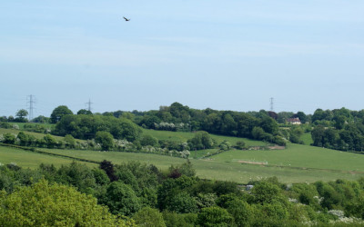 ‘Last Chance (HS)To See’, 18th May 2018:
 ‘Last Chance (HS)To See’, 18th May 2018:
 ‘Last Chance (HS)To See’, 18th May 2018:
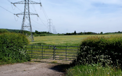 ‘Last Chance (HS)To See’, 18th May 2018:
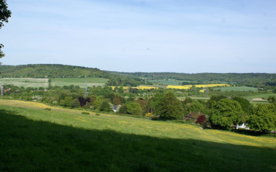 ‘Last Chance (HS)To See’, 18th May 2018:
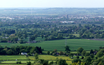 ‘Last Chance (HS)To See’, 18th May 2018: