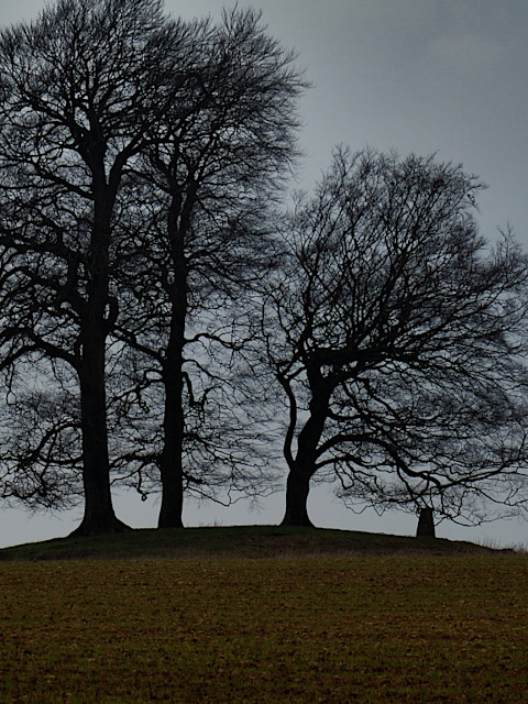


On the windswept hill, with views for miles across the local landscape, many might miss the large round barrow that sits on top of the hill – or think it part of the trigpoint unceremoniously planted on top.
Historic England class this as a bowl barrow. Though rather smaller than the one in Besbury Lane near Churchill, visible down the valley from here, its of a similar original size.
Built from the Late Neolithic into the Bronze Age, roughly 3,500 to 4,500 years ago, it represents the culture who first widely farmed the hilltops hereabouts. As well as originally standing much taller, there was a broad deep ditch around it, now filled in by material eroded from the land around.
 © 2023 Paul Mobbs; released under the Creative Commons license.
Created: 19th April 2021;
Updated: 19th April 2023.
Length: ~500 words.
Location: Wyck Rissington, Gloucestershire
Type: ‘Barrows, Tumuli, and Earthworks’.
Condition: Well preserved bowl barrow.
Access: No public access; visible in field just over hedge next to the road junction, with good views from the bridlepath that runs around the back of the field.
OS Grid Ref.: SP201207.
Further information: Historic England.
This high hilltop is also a significant ridge route, as two significant tracks converge near here:
The best views of the site are from the bridleway that runs across the ridge on the far side of the field. Years ago I used to cycle out here from Banbury, to see the view and make a brew. It never occurred to me to look in the other direction, until a few years later when I walked over the top of the Beacon from Bourton-on-the-Water to Kingham.
To be honest, when I re-visit here it’s still to take in the view, but I always check on the barrow too. Whether walking up from Roman Bourton-on-the-Water, or traversing the lovely ridge walk out from Kingham station, it's a great spot to take a long lingering lunch, gazing out across the rolling hills of the North Cotswolds.