
Banburyshire Rambles Photo-Journal
Paul Mobbs’ photographic record of his walks around ‘Banburyshire’ and ‘The Irondowns’, and occasionally, as part of his work around Britain, the areas beyond.
![]()

‘Last Chance (HS)To See’ index
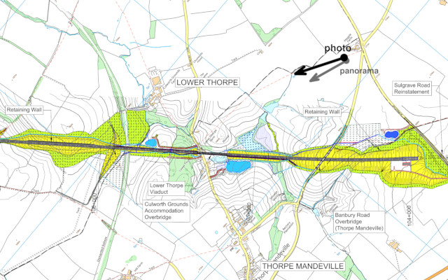
View Ordnance Survey map for this site
View HS2 route map for this site
‘Last Chance (HS)To See’ – Scene 32:
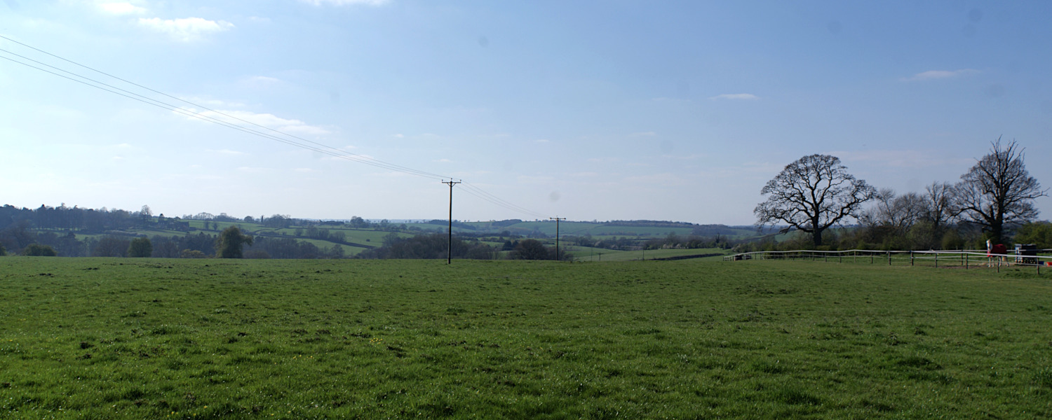
‘Banbury Lane, Culworth’
Near to where the Medieval trackways of ‘Banbury Lane’ and ‘The Portway’ cross I view the scene across broad valley between this ridge and Edgecote Hill, where HS2 crosses on a viaduct
11th April 2019
© 2018-2021 Paul Mobbs; released under the  Creative Commons license.
Updated February 2021.
This exposed ridge always catches the weather; at 171 metres (560 feet) above sea level, to the East of here the land gradually falls all the way to The Wash and the East Anglian coast. This was once a major thoroughfare, on foot. Trackways from the north east converged here, to cross past Banbury down toward The Cotswolds, or to follow the ridge south into the Thames valley. Now, HS2 is on its way.
In frosty weather, when the boggy fields are firm enough to walk over at speed, this area was always a good place to come to experience something a little more climatically extreme.
HS2 has to climb over the hill here – at roughly the same height of where the line emerges from the Chilterns Tunnel at South Heath. And just as with the landscape of the upper Misbourne valley, where the route falls down the hill into Wendover, the route here is every bit as intrusive.
Despite Banbury Lane still being a rat-run for traffic from Banbury towards Northampton, it is still possible to find tranquillity here once you get off the ridge into the valley below, and head towards Edgecote Hill (the hill in the distance of the panorama, below). That deserted stretch of countryside is where HS2 gouges a path from here, through Otmoor and on into Warwickshire.
Panorama from Banbury Lane
Use the slider to move the view from side to side
Load map of this location.