
Banburyshire Rambles Photo-Journal
Paul Mobbs’ photographic record of his walks around ‘Banburyshire’ and ‘The Irondowns’, and occasionally, as part of his work around Britain, the areas beyond.
![]()
‘Last Chance (HS)To See’ index
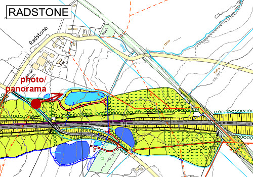
View Ordnance Survey map for this site
View HS2 route map for this site
‘Last Chance (HS)To See’ – Scene 14:
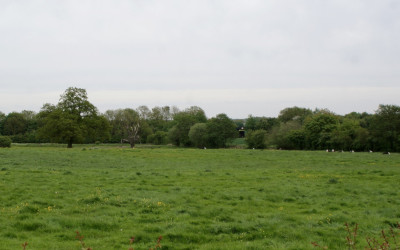
‘Radstone Water Meadows, West’
Remodelling the landscape to manage HS2's surface water
11th May 2018
© 2018-2021 Paul Mobbs; released under the  Creative Commons license.
Updated February 2021.
One the key problems created by the massive scale of HS2's engineering, in particular the large surface area of its 'green cuttings', is the management of surface water (especially from sudden heavy rainfall events). This has to be controlled to prevent flooding at the drainage points from the route – Radstone being a prime example.
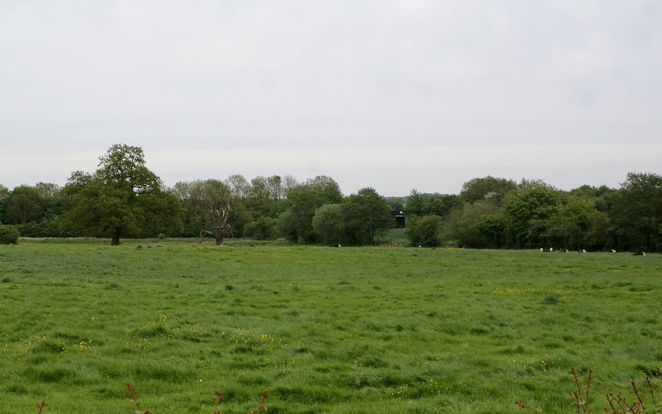
Note – the bridge shown near the centre of the above image is the road underpass beneath the embankment/trackbed of the disused Great Central Mainline.
South of Radstone, the small stream cuts through the overlying glacial geology and through the bands of limestone and sand below. The bottom of the valley consists of impermeable Whitby Mudstone Group clays. This is creates a wet water meadow – fed by groundwater from the permeable water-bearing strata above, and contained by the impermeable clays at the bottom.
In order to manage the surface water generated by the broad cuttings to the north and south of Radstone, and the improved roadway, three large pond areas will be constructed, plus two smaller ponds:
The two large ponds south of the track (dark blue) are 'land drainage areas'. These will by mostly dry or boggy for much of the time as they manage drainage from the cuttings, but during periods of high rainfall they will buffer large volumes of water – releasing it more slowly in order to prevent flooding.
The smaller ponds to the south and north of the track, and the large pond to the north of the track (light blue), are 'balancing ponds'. These are more engineered structures which manage local surface drainage from roads and hardstandings, designed to hold-back water from the local stream in the event of high levels of water run-off – though for much of the time they will be dry.
The other obvious issue is that as the principal drainage point from the trackbed, these ponds will also intercept any pollutants running off from the line – be that herbicides used for management of the trackbed, or substances emanating from the rolling stock and falling onto the ballast below.
The issue with creating large engineered structures which only occasionally fill with water is that they can lead to a change in the surface ecology of the area. How beneficial, or otherwise these areas would be to the local ecology is entirely dependent upon their management – creating valued habitats, and more importantly eliminating invasive species and coarse vegetation. As yet the management of these ponds is not clearly stated, as much of the attention in terms of land management has been on landscaping, not the ecological management of the drainage infrastructure.
Panorama over Radstone’s meadows from the west
Use the slider to move the view from side to side
Load map of this location.