
Banburyshire Rambles Photo-Journal
Paul Mobbs’ photographic record of his walks around ‘Banburyshire’ and ‘The Irondowns’, and occasionally, as part of his work around Britain, the areas beyond.
![]()

‘Last Chance (HS)To See’ index
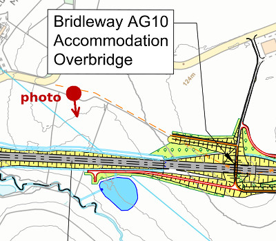
View Ordnance Survey map for this site
View HS2 route map for this site
‘Last Chance (HS)To See’ – Scene 2:
‘Looking at the new HS2 embankment, Danesmoor Battlefield’
A historic battlefield on the crossroads of British history
9th March 2018
© 2018-2021 Paul Mobbs; released under the  Creative Commons license.
Updated February 2021.
It’s ironic that one of the places you could go locally to find peace should be a nationally significant battleground – twice-over: Once during the 10th Century battles with the Danes that created a united Saxon England; and a second time during the 15th Century Wars of the Roses that created Tudor England.
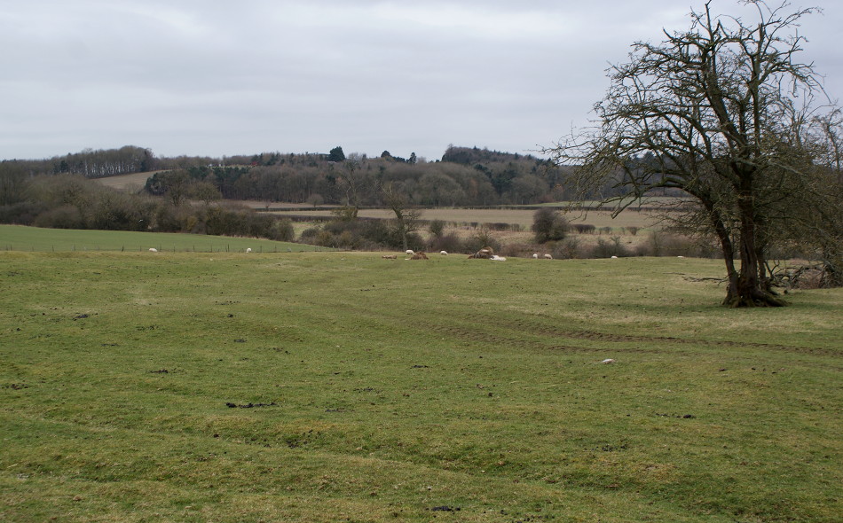
It’s so peaceful here. Much of Danesmoor is sheltered by hills, meaning that it’s shielded from the noise of nearby major roads. For me it’s one of the few local locations where you can come to escape the development pressures that have spread across this area in the last few decades.
Not for much longer though. HS2 is planned to go straight through the middle of the Danesmoor valley – directly in front of where this picture is taken, where you can see the sheep – on an embankment.
The flat land beyond the grassy field in the foreground was the site of the Battle of Edgcote Moor, on 26th July 1469. This was one of the key battles in the Wars of the Roses, when the Plantagenet kings and their historic connections to France were displaced by the more Anglicized House of York.
Just over 500 years before that, this valley was the site of the Battle of Danes Moor in 914, when the combined forces of the Saxon kingdoms of Wessex and Mercia pushed back the frontier of Danelaw. The final end of Danish influence, and the uniting of Saxon England, took place 40 years later in 954 – to be overturned a century later in the Norman Conquest.
Why should two battles have taken place here?
This was once where the prehistoric north-east/south-west course of the Jurassic Way – an ancient ridge-route following the line of the Jurassic hills from Lincolnshire to Stonehenge – crossed the northwest-southeast course of the Medieval Welsh Lane – which connected the South East to the West Midlands and North Wales.
The new railway embankment doesn’t intrude directly onto the 1469 battlefield, but that’s not the point. The battlefield is only a historical curiosity. The issue here is that by raising the trackbed onto an embankment, the noise created by passing trains will spread out over a wider area, ending the relative serenity that can be found in this isolated valley.